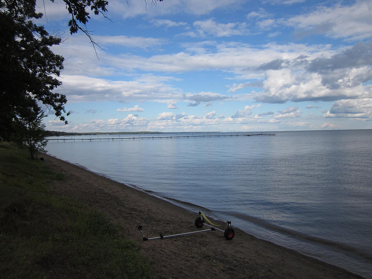
Mille Lacs Lake
Aitkin County, Minnesota128,250 acresView mapDirections
Minnesota PCA publishes the water-quality measurements for Mille Lacs Lake. Here is what has been measured.
- Impaired · Mercury
- 3 aquatic invasives
- 42 ft max depth
- Public access
- Limited data
Mille Lacs Lake in Aitkin County, Minnesota has water-quality measurements published by Minnesota PCA, shown here as reported. Water clarity: 10 ft visibility. Maximum depth: 42 ft. Surface area: 128250.02 acres.
Minnesota DNR's Standard Survey on April 14, 2025 caught 9.73 walleye per gill net at Mille Lacs Lake. Length samples in the latest survey that recorded them ran 3–28 inches. DNR survey details →
Mille Lacs Lake is a 128,250-acre lake in Aitkin County, Minnesota with a maximum depth of 42 feet (29-foot average). Overall water quality is declining over recent sampling years. The lake supports 21 documented fish species including black bullhead, black crappie, and bluegill. Public access is available.
Source: EPA Water Quality Portal sampling records, Minnesota DNR LakeFinder, last sampled 2025-09-13. Methodology: how these readings are compared.
At about 128,000 acres, Mille Lacs Lake is large enough that where you stay decides which shore you see most of. The median ice-out date is April 25, which is when the open-water season begins. Vrbo is where to look for cabins and lake homes around Mille Lacs Lake, and Booking.com and Expedia search hotels near the lake for your dates.
What Mille Lacs Lake is good for
From access and monitoring records, not editorial picks.
- Clear water10 ft of visibility
- Fishing21 species recorded
- Ice seasonIce-out around Apr 25
- Deep water42 ft surveyed max depth
- Big water128,250 acres
Mille Lacs Lake Water Quality Summary (2026)
A printable one-page summary for Mille Lacs Lake: clarity, phosphorus, algae, multi-year trend, depth, and fish — with sources.
Swimming conditions
No readingLimited data
Nutrient and algae readings are not a swimming clearance. Mille Lacs Lake is listed impaired under Clean Water Act §303(d) (IR 4A) for mercury. Check local advisories before you swim.
Whether Mille Lacs Lake is safe to swim in today is a call for the Minnesota Pollution Control Agency and the Minnesota DNR and the county health department, who post current advisories. LakeQuality does not issue swimming clearances.
Water quality measurements for Mille Lacs Lake
These are the measurements Minnesota PCA publishes for Mille Lacs Lake, shown as reported. The condition class beside each reading is the EPA National Lakes Assessment class for this lake’s ecoregion.
Good clarity, visible to about 10 ft. TSI 44.
| Measure | Reading | Where it sits |
|---|---|---|
| Water clarity (Secchi depth) | 10ft | Measured, not scored How deep a black-and-white disk stays visible from the surface. Higher is clearer. |
| Total phosphorus | No reading The nutrient that most limits algae growth in freshwater. More phosphorus, more algae potential. | |
| Chlorophyll-a (algae) | No reading The green pigment in algae — a direct measure of how much algae is in the water. | |
| Trophic state (TSI)Carlson's 0–100 index of how much algae a lake can support, from clarity, phosphorus and chlorophyll-a. | 44 | Mesotrophic OligotrophicMesotrophicEutrophicHypereutrophic |
Moderate nutrients, good water quality
Ask about Mille Lacs Lake
Answers come straight from the public measurements and survey records on this page.
Current Conditions
USGS snapshot Jul 6, 2026, 4:15 AM from gauge 05284000 (Mille Lacs Lake Nr Garrison, MN). Station page ↗ — a live reading replaces this snapshot when the gauge responds. Missing live data is not an all-clear.
Blue-Green Algae (Cyanobacteria)
There’s no recent EPA CyAN cyanobacteria estimate for Mille Lacs Lake — clouds, ice, or an off-season gap in coverage. The most recent reading was moderate (30,479 cells/mL) on October 11, 2025.
Blue-green algae can appear and clear within days, so check your state’s current advisory before swimming. EPA CyAN ↗
Minnesota DNR's Standard Survey on April 14, 2025 caught 9.73 walleye per gill net at Mille Lacs Lake. Length samples in the latest survey that recorded them ran 3–28 inches.
A DNR fisheries survey reports fish abundance and catch rates, not water quality. LakeQuality shows Mille Lacs Lake’s water-quality measurements separately, and the water-quality trend over 6 years of monitoring is declining. Catch rate is not a swim clearance and is not a weekly bite report.
DNR Fisheries Survey Summary
37 surveys on file from MN DNR Fisheries. Most recent: 2025-04-14 (Standard Survey).
37 surveys on file · most recent 2025-04-14 (Standard Survey)
| Species | Catch rate (CPUE) | Size | Avg weight |
|---|---|---|---|
| Yellow Perch | 215.51 | 2–13 in 2025-04-14 | 0.22 lb |
| Spottail Shiner | 70.94 | 2–5 in 2025-04-14 | 0.02 lb |
| Walleye | 68.29 | 3–28 in 2025-04-14 | 1.24 lb |
| Tullibee (Cisco) | 17.53 | 3–17 in 2025-04-14 | 0.6 lb |
| Smallmouth Bass | 17.32 | 1–22 in 2025-04-14 | 1.76 lb |
| Bluntnose Minnow | 13.01 | 3 in 2025-04-14 | 0.01 lb |
CPUE = catch per unit effort, fish caught per net per set in a standardised survey. It measures abundance, not size, and is not a weekly bite report.
Length Distributions
Number of fish caught at each inch class in the most recent survey that recorded lengths. Red dashed line marks an approximate trophy threshold for that species.
Yellow Perch
Spottail Shiner
Walleye
Tullibee (Cisco)
From the 2025-04-14 survey
Sampling Programs Mille Lacs Lake is one of ten lakes in Minnesota's Large Lake Program. These lakes have annual sampling of the fish populations, and frequent creel surveys. Specific to Mille Lacs Lake, sampling programs focusing on Walleye, Yellow Perch, Smallmouth Bass, and Northern Pike are conducted annually.…
DNR Reports & Resources
Minnesota DNR LakeFinder publishes lake survey, fish stocking, water access, and aquatic plant data for Mille Lacs Lake. 5 reports on file.
These links open on the official state DNR websites (Wisconsin DNR survey PDFs · Minnesota DNR LakeFinder).
- —Fisheries Lake Survey — Mille LacsFisheries Lake Survey · MN DNR LakeFinder
- —Aquatic Plant Report — Mille Lacs (0134)Aquatic Plant Report · MN DNR LakeFinder
- —Aquatic Plant Report — Mille Lacs (0337)Aquatic Plant Report · MN DNR LakeFinder
- —Fish Stocking History — Mille LacsFish Stocking History · MN DNR LakeFinder
- —Public Water Access Sites — Mille LacsPublic Water Access Sites · MN DNR LakeFinder
Lake Details
Max depth
42 ft
Average depth
28.5 ft
Surface area
128,250 acres
Shoreline
105.5 mi
Littoral zone
26%
Share shallower than 15 ft
Public access
Yes
Listed by Minnesota PCA
Stays via Stay22
Stays near Mille Lacs Lake
Compare lakeside cabins, hotels, and vacation rentals near Mille Lacs Lake in Aitkin County, Minnesota — live availability and prices for your trip. Switch the map to Satellite to see the lake and how close each stay is to the water.
Top-rated places to stay near Mille Lacs Lake
Prices for Oct 9–11, 4 adults. Change dates on the map below.
Availability and prices from Stay22 partners (Booking.com, Vrbo, Expedia). We may earn a commission from bookings, at no extra cost to you.
Planning a trip? Cabins and lodging at Mille Lacs Lake → · more Minnesota lake trips
Follow Mille Lacs Lake’s readings
Email me when new measurements post for this lake. Updates stay free.
Or email
Fish Species
Click a species to see every lake where it is documented.
Fishing Mille Lacs Lake
Invasive & Introduced Species
Red chips are ecologically harmful invasive species. Gray chips are stocked or introduced fish that aren't a current ecological concern.
Water Quality Trend: Worsening
Based on 6 years of monitoring (2020–2025).
Water clarity
Worsening6 years
Ice season
Typical ice-out
Apr 25
Earliest Mar 16, 2024 · Latest May 16, 2013
Typical ice-in
Dec 3
Earliest Nov 19, 1996 · Latest Dec 22, 2001
Most recent ice-out
Apr 18
2025
123 observations · Minnesota PCA ice records
EPA Impairment Status
Mille Lacs Lake is officially listed as impaired under Clean Water Act §303(d) in the 2024 EPA reporting cycle (IR category 4A).
Causes of impairment
Designated uses not supporting: Fish consumption.
A Total Maximum Daily Load (TMDL) plan has been approved.
Source: EPA ATTAINS assessment unit MN48-0002-00 · Official waterbody report
Nearby Lakes in Aitkin County
Frequently asked questions about Mille Lacs Lake
Where is Mille Lacs Lake?
- Mille Lacs Lake is a lake in Aitkin County, Minnesota. Its water-quality measurements are published by Minnesota PCA and shown on this page as reported.
What is the water quality of Mille Lacs Lake?
- Mille Lacs Lake in Aitkin County, Minnesota has water-quality measurements published by Minnesota PCA, shown here as reported. Water clarity: 10 ft visibility. Maximum depth: 42 ft. Surface area: 128250.02 acres.
Is Mille Lacs Lake safe to swim in?
- Nutrient and algae readings are not a swimming clearance. Mille Lacs Lake is listed impaired under Clean Water Act §303(d) (IR 4A) for mercury. Check local advisories before you swim.
How deep is Mille Lacs Lake?
- Mille Lacs Lake has a maximum depth of 42 feet and an average depth of 28.5 feet. The lake covers 128250.02 acres.
What fish are in Mille Lacs Lake?
- Fish species found in Mille Lacs Lake include black bullhead, black crappie, bluegill, bowfin (dogfish), brown bullhead, burbot, common carp, green sunfish, hybrid sunfish, largemouth bass, muskellunge, northern pike, pumpkinseed, rock bass, shorthead redhorse, smallmouth bass, tullibee (cisco), walleye, white sucker, yellow bullhead, yellow perch. Mille Lacs Lake is located in Aitkin County, Minnesota.
What did the DNR fisheries survey find at Mille Lacs Lake?
- Minnesota DNR's Standard Survey on April 14, 2025 caught 9.73 walleye per gill net at Mille Lacs Lake. Length samples in the latest survey that recorded them ran 3–28 inches. A DNR fisheries survey reports fish abundance and catch rates, not water quality. LakeQuality shows Mille Lacs Lake’s water-quality measurements separately, and the water-quality trend over 6 years of monitoring is declining. Catch rate is not a swim clearance and is not a weekly bite report.
When does Mille Lacs Lake thaw?
- Mille Lacs Lake typically has ice-out around Apr 25. Ice typically forms around Dec 3. The open water season is approximately 222 days.
What is the water level at Mille Lacs Lake?
- The USGS snapshot on this page for Mille Lacs Lake is 10.99 ft of gage height, recorded Jul 6, 2026, 4:15 AM at gauge 05284000. Current Conditions hydrates a live NWIS reading from that same station when the gauge responds. A missed live fetch is not an all-clear.
Does Mille Lacs Lake have blue-green algae?
- There is no recent EPA CyAN cyanobacteria estimate for Mille Lacs Lake (clouds, ice, or an off-season gap). The most recent reading was moderate (30,479 cells/mL). Blue-green algae can appear and clear within days, so check Minnesota's current advisory before swimming.
Can I fish at Mille Lacs Lake?
- Public access to Mille Lacs Lake is listed as yes on the lake record. Seasons, size and bag limits, and whether you need a license are set by Minnesota's fish and wildlife agency, so check its current regulations before you go.
Explore Mille Lacs Lake across LakeQuality
Depth, room, public access, and the state wake-sport rules
Fish species and the cleanest lakes across Minnesota
Fish species and best lakes in Aitkin County
Species activity outlook by water temperature and season
Top lakes and where to stay in the Brainerd Lakes area
Top lakes and where to stay in the Mille Lacs Area area
Where to stay at Minnesota's top lakes, each with its readings
Lakes in the Rum River Watershed, ranked by water quality
Lakes in the Pine River Watersheds (Brainerd Lakes), ranked by water quality
Minnesota's cleanest lakes, ranked on agency measurements
More lakes in Minnesota
State Parks Near Mille Lacs Lake
Other Lakes in Minnesota
Mesotrophic Lakes in Minnesota
Where this data comes from
65 measurements from 2 monitoring stations, 2020–2025. Retrieved from the EPA Water Quality Portal on 2026-08-02.
Collected and reported by
- Minnesota Pollution Control Agency - Ambient Surface Water
MNPCA65 samples · 2020–2025
Analytical methods
- Field measurement/observation, generic method
Monitoring station identifiers (2)
EPA condition classes from the National Lakes Assessment (EPA 841-R-24-006, Table 6-3), applied by ecoregion. See where the data comes from and data sources.
Other records on this page
Impairment status from EPA ATTAINS 303(d) database
Lake details from Minnesota DNR LakeFinder
Ice data from Minnesota DNR Climate